Maptionaire

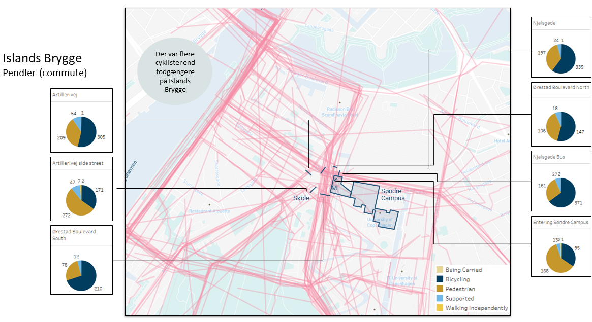
Islands Brygge – routes for daily commute
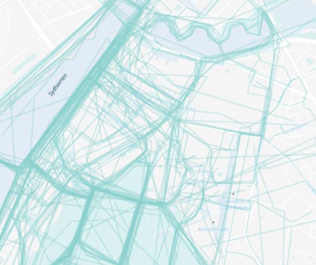
Islands Brygge – leisure time routes
Maptionaire is an online survey platform using maps and images as an engaging way to have people express opinions and identify their uses of public spaces in their neighbourhood as well as qualities that are important to them.
Analysis of data from maptionaire allows for key public spaces to be mapped in terms of use, qualities and perceptions of air quality, as well as routes used for different purposes – according to different user groups.
A total of 773 citizens responded, and some key insights from this project is a strong interest in, and use of, green and blue spaces, but also many underused spaces in both neighbourhoods (i.e. Ørestad and Islands Brygge). It also showed that people tend to take cleaner routes in their free time, and that they choose major roads when commuting.
Public Life Survey
Public life survey is the observation of use patterns of public spaces at different times of day as well as types of activities, and among gender and age groups. It tracks people’s movement in terms of mode as well as people spending time. Our public life survey is coupled with the registration of public space qualities in terms of security, comfort, and enjoyment.
Observations of public life demonstrated an imbalance in the public life of Ørestad with some places like the local park being able to attract a diverse type of public life, as well as many different age groups, whereas other spaces had very little activity. In Islands Brygge the local park had a lot less activity and was mainly centered around one type of activity only.
Observations of public spaces identified some key challenges in terms of lack of program and invitation in the local park in Islands Brygge and a lack of human scale in many of the public spaces, especially in Ørestad, with wind and noise being real issues.